https://creativecommons.org/publicdomain/zero/1.0/https://www.rawpixel.com/image/8937718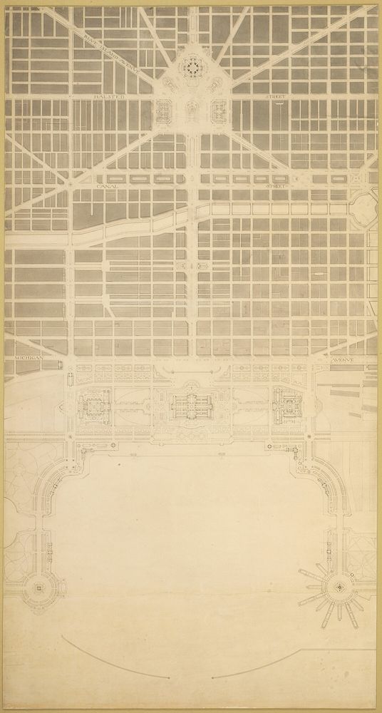
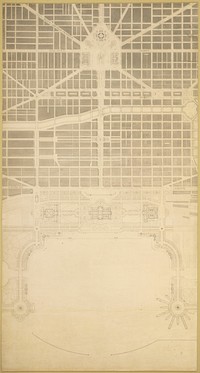
Plate 129 from The Plan of Chicago, 1909: Chicago. The Business Center of the City, Within the First Circuit Boulevard, Showing the Proposed Grand East-and-West Axis and Its Relation to Grant Park and the Yacht Harbor; the Railway Terminals Schemes on the South and West Sides, and the Civic Center by Daniel Hudson Burnham (Architect)
Plate 129 from The Plan of Chicago, 1909: Chicago. The Business Center of the City, Within the First Circuit Boulevard, Showing the Proposed Grand East-and-West Axis and Its Relation to Grant Park and the Yacht Harbor; the Railway Terminals Schemes on the South and West Sides, and the Civic Center by Daniel Hudson Burnham (Architect)
Original public domain image from Art Institute of Chicago
Public DomainFree CC0 image for Personal and Business use