https://creativecommons.org/publicdomain/zero/1.0/https://www.rawpixel.com/image/8907101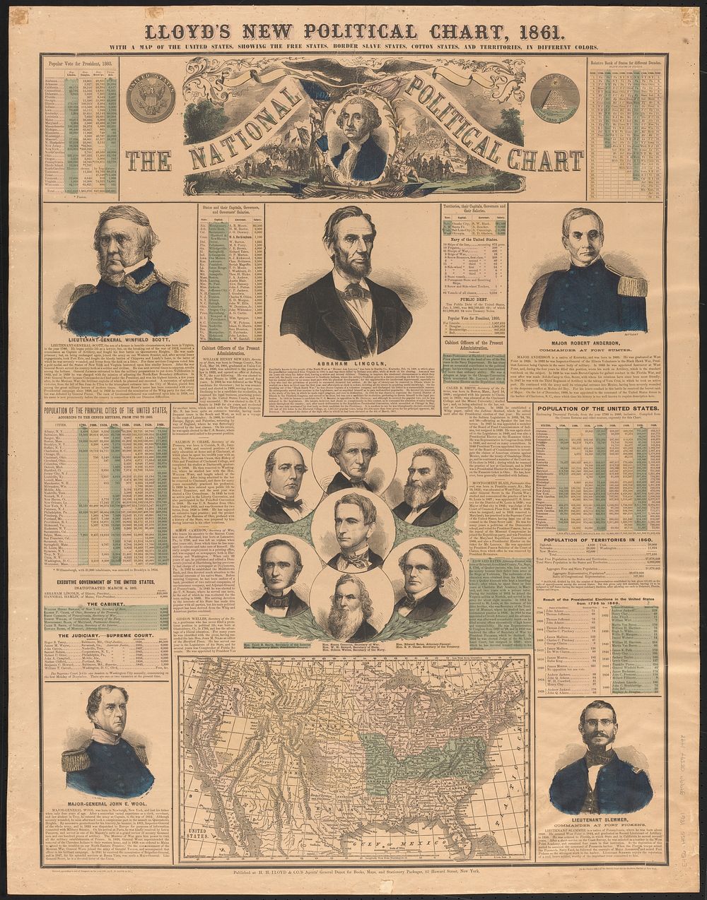
Lloyd's new political chart, 1861 : with a map of the United States, showing the free states, border slave states, cotton states, and territories, in different colors
Original public domain image from Digital Commonwealth
Public DomainFree CC0 image for Personal and Business use