https://creativecommons.org/publicdomain/zero/1.0/https://www.rawpixel.com/image/8718124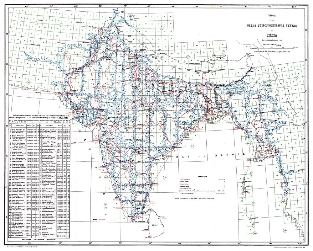
Index to the Great Trigonometrical Survey of India (1922). India is shown on a 1-degree grid of green lines. The blue triangles indicate the Great Trigonometrical w:triangulation measurements. Triangulation series are indicated by a number in parentheses. These series are described in the table at the bottom left. The red dash-dot lines are telegraph longitude area.Among the many accomplishments of the Survey were the demarcation of the British territories in India and the measurement of the height of the Himalayan giants: Everest, K2, and Kanchenjunga.
Index to the Great Trigonometrical Survey of India (1922). India is shown on a 1-degree grid of green lines. The blue triangles indicate the Great Trigonometrical w:triangulation measurements. Triangulation series are indicated by a number in parentheses. These series are described in the table at the bottom left. The red dash-dot lines are telegraph longitude area.Among the many accomplishments of the Survey were the demarcation of the British territories in India and the measurement of the height of the Himalayan giants: Everest, K2, and Kanchenjunga.
Original public domain image from Wikimedia Commons
Public DomainFree CC0 image for Personal and Business use