https://creativecommons.org/publicdomain/zero/1.0/https://www.rawpixel.com/image/8044022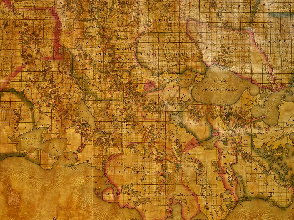
A portion of John La Tourrette's historic (and giant) 1848 reference map of Louisiana showing land ownership and plantation boundaries
A portion of John La Tourrette's historic (and giant) 1848 reference map of Louisiana showing land ownership and plantation boundaries
Original public domain image from Library of Congress
Public DomainFree CC0 image for Personal and Business use