https://creativecommons.org/publicdomain/zero/1.0/https://www.rawpixel.com/image/7666571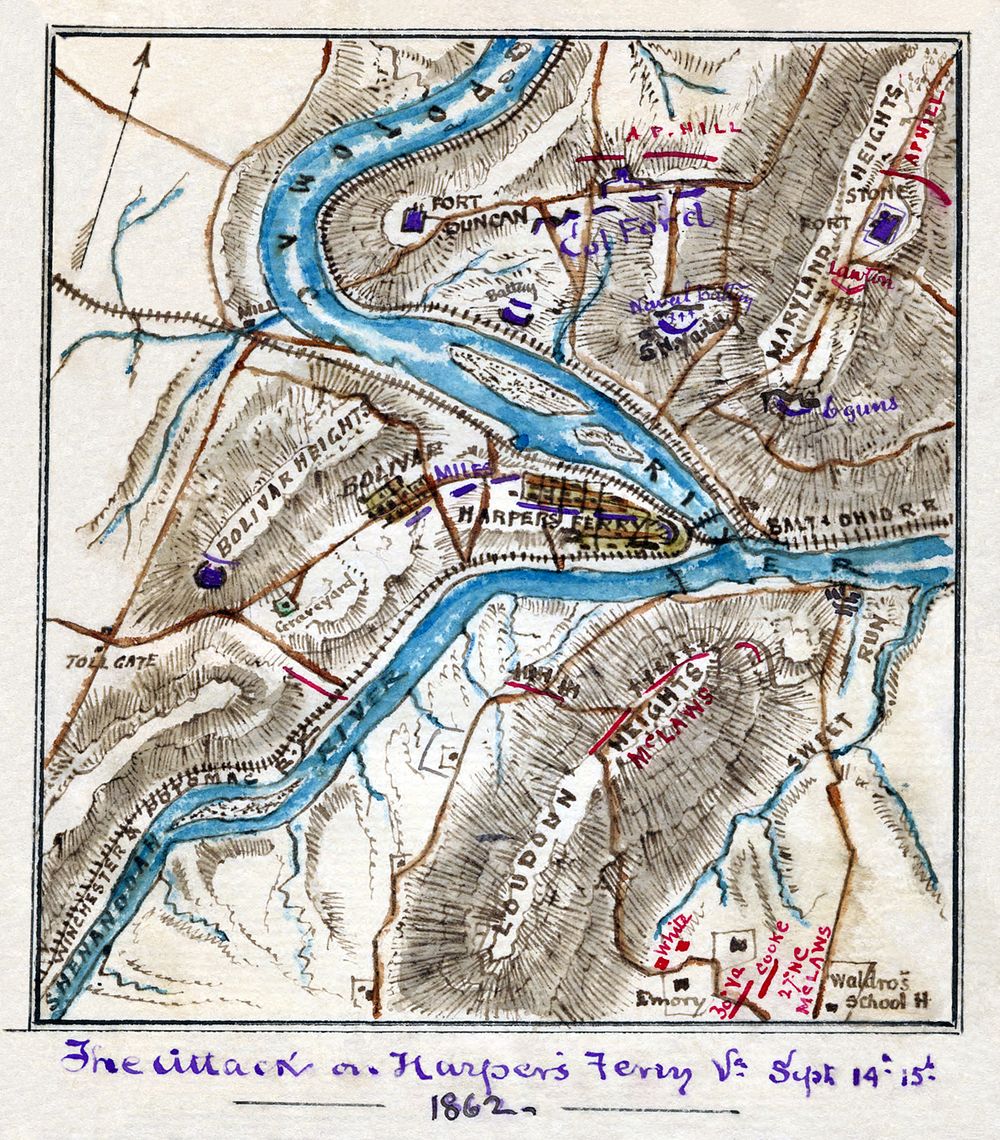
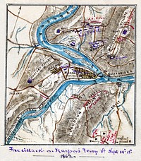
Scan of a manuscript map by a Union Army mapmaker during the American Civil War. Shows the area surrounding Harper's Ferry, W. Va., at the intersection of the Potomac and Shenandoah Rivers as the Confederate forces under Jackson began their assault, Sept. 12-15, 1862.
Scan of a manuscript map by a Union Army mapmaker during the American Civil War. Shows the area surrounding Harper's Ferry, W. Va., at the intersection of the Potomac and Shenandoah Rivers as the Confederate forces under Jackson began their assault, Sept. 12-15, 1862.
Original public domain image from Wikimedia Commons
Public DomainFree CC0 image for Personal and Business use