https://creativecommons.org/publicdomain/zero/1.0/https://www.rawpixel.com/image/7666539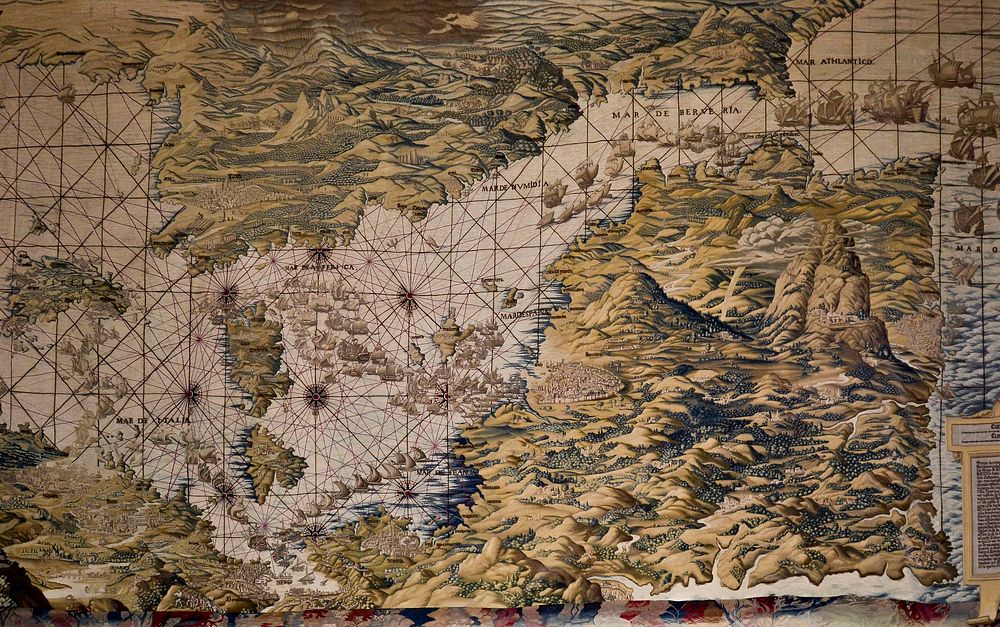
Map of Mediterranean Basin. First tapestry of the series dedicated to the Conquest of Tunis in 1535 by Charles V, Holy Roman Emperor, and its allies. Jan Vermeyen presents the Western Mediterranean Sea map. This is the first south-up oriented map in the History. This Spanish set of the Conquest of Tunis was woven after the original cartoons (now in Vienna, Kunsthistorisches Museum, Sammlungen des allerhöchsten Kaiserhauses) designed by Jan Cornelis Vermeyen & woven by Wilhelm de Pannemaker in 1549-1551.
Map of Mediterranean Basin. First tapestry of the series dedicated to the Conquest of Tunis in 1535 by Charles V, Holy Roman Emperor, and its allies. Jan Vermeyen presents the Western Mediterranean Sea map. This is the first south-up oriented map in the History. This Spanish set of the Conquest of Tunis was woven after the original cartoons (now in Vienna, Kunsthistorisches Museum, Sammlungen des allerhöchsten Kaiserhauses) designed by Jan Cornelis Vermeyen & woven by Wilhelm de Pannemaker in 1549-1551.
Original public domain image from Wikimedia Commons
Public DomainFree CC0 image for Personal and Business use