https://creativecommons.org/publicdomain/zero/1.0/https://www.rawpixel.com/image/7665197
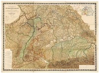
Wall map of Southwestern Germany, which includes the Kingdom of Bavaria, Kingdom of Württemberg, the Grand Duchies of Baden and Hessen, the Principality of Hohenzollern, and the Imperial territory of Alsace-Lorraine, 1875. Edited by Dr Heinrich Moehl.
Wall map of Southwestern Germany, which includes the Kingdom of Bavaria, Kingdom of Württemberg, the Grand Duchies of Baden and Hessen, the Principality of Hohenzollern, and the Imperial territory of Alsace-Lorraine, 1875. Edited by Dr Heinrich Moehl.
Original public domain image from Wikimedia Commons
Public DomainFree CC0 image for Personal and Business use